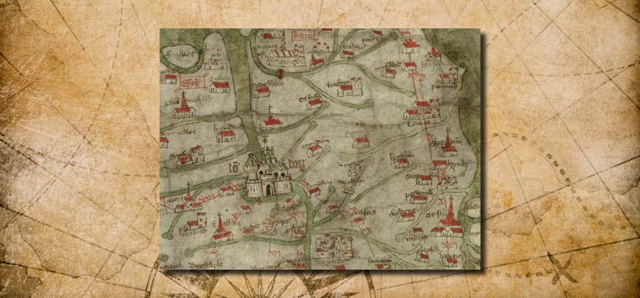
Understanding the Gough Map: an application of physics, chemistry and history
This multidisciplinary project received funding from the Leverhulme Trust for the lead academics at the IHR and the Bodleian Library, University of Oxford, who worked with scholars across Great Britain to study the map’s regional content, provide the first dedicated study of the places-names and pictorial features, and examine the map’s codiocological aspects. This started as a 3-year project in 2019 but has been delayed due to the pandemic and is now heading towards its closing stages. The description here offers a summary of this exciting project:
https://blog.history.ac.uk/2019/08/understanding-the-gough-map-the-application-of-physics-chemistry-and-history/
As one of those scholars involved, Dr Sheila Sweetinbugh has been researching and writing on the counties of Kent and Surrey, while Dr Alex Kent, formerly CCCU, now English Heritage, is investigating Sussex and Hampshire. As part of a one-day conference on historic maps and mapmaking, organised as an outreach event in 2022 by the Centre in conjunction with Canterbury Cathedral Archives, Sheila spoke on the Kent section of the Gough Map:
https://blogs.canterbury.ac.uk/kenthistory/canterbury-maps-and-mapmakers-plus-other-events/